Shaoxing unveils map revealing city layout 800 years ago

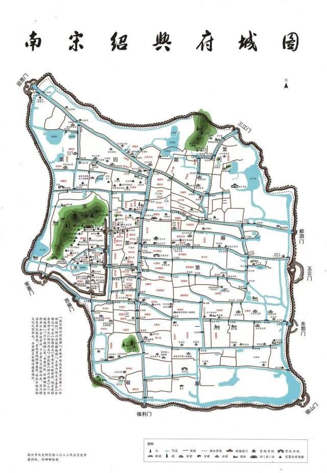
A map of Shaoxing during the Southern Song Dynasty. [Photo/Hangzhou Daily]
A map of Shaoxing in East China's Zhejiang province during the Southern Song Dynasty (1127-1279) featuring 436 locations was unveiled recently.
It was created over a span of three years by Tu Jianhong, a researcher at the Shaoxing Municipal Research Institute of Culture and History, and Xu Shanshan, a teacher at Zhejiang Industry Polytechnic College.
During the press conference, Feng Jianrong, head of the research institute, explained that during the Southern Song Dynasty, Shaoxing optimized its urban layout, dividing the city into five counties and 96 blocks. The spatial pattern of the city during that time has been largely preserved until today.
Some names of the blocks, known as "fang (坊)" at that time, such as Fumin Fang, Wuxun Fang, and Yuechi Fang, are still used to this day.
According to Wu Zhiqiang, an academician from the Chinese Academy of Engineering, the map, which restores the ancient city of Shaoxing in cartographic form, is the first of its kind in China and provides an innovative example for the preservation of ancient cities.
Shi Huifang, mayor of Shaoxing, said the map not only holds significant academic value, but also contributes to the integration of culture, commerce, and tourism.


 Shaoxing Showdowns
 Zhejiang: A Decade of Progress
 Shaoxing in expats' eyes